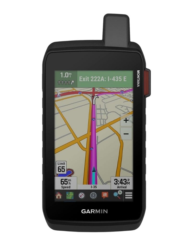
Garmin Montana 710i
Garmin
KES 140,000.00
Description
The Garmin Montana® 710i is a rugged, high-performance handheld GPS designed for serious outdoor adventurers, overlanders, hikers, and explorers who need reliable navigation and communication beyond mobile network coverage. Built to thrive in extreme environments, it combines advanced mapping, satellite communication, and durable construction into one powerful device.
At the heart of the Montana 710i is its large 5-inch dual-orientation touchscreen, which is easy to read even in bright sunlight and responsive enough for use with gloves. The display provides a clear, detailed view of maps, routes, and data, making navigation seamless whether you’re hiking, cycling, or driving off-road.
One of its standout features is inReach® satellite technology, enabling two-way messaging and interactive SOS alerts via the global Iridium satellite network. This ensures you can stay connected or call for help even in remote areas without cellular coverage (subscription required).
For navigation, the device supports multi-GNSS systems (GPS, GLONASS, and Galileo), delivering highly accurate positioning even in challenging environments such as dense forests or deep valleys. It also includes preloaded TopoActive maps, with the ability to download additional maps and satellite imagery for enhanced route planning and exploration.
At the heart of the Montana 710i is its large 5-inch dual-orientation touchscreen, which is easy to read even in bright sunlight and responsive enough for use with gloves. The display provides a clear, detailed view of maps, routes, and data, making navigation seamless whether you’re hiking, cycling, or driving off-road.
One of its standout features is inReach® satellite technology, enabling two-way messaging and interactive SOS alerts via the global Iridium satellite network. This ensures you can stay connected or call for help even in remote areas without cellular coverage (subscription required).
For navigation, the device supports multi-GNSS systems (GPS, GLONASS, and Galileo), delivering highly accurate positioning even in challenging environments such as dense forests or deep valleys. It also includes preloaded TopoActive maps, with the ability to download additional maps and satellite imagery for enhanced route planning and exploration.
Specifications
- Warranty: 1-Year Limited Apple Warranty | Includes hardware repair coverage and technical support from iStore Kenya.
- inReach® Satellite Technology: Enables global two-way text messaging, interactive SOS emergency alerts to 24/7 response centers, and live tracking shareable via the Iridium satellite network (subscription required).
- Display: Sunlight-readable WVGA touchscreen (480 × 800 pixels) that is glove-friendly and supports both portrait and landscape orientations.
- Rugged Construction: Tested to MIL-STD-810 standards for thermal, shock, and vibration resistance, featuring an IPX7 water-resistance rating.
- Multi-GNSS Support: Accesses GPS and Galileo satellite networks for improved accuracy in deep valleys, dense canopy, or remote terrain.
- Preloaded Mapping: Includes TopoActive maps and City Navigator road routing, along with direct-to-device BirdsEye satellite imagery downloads.
- ABC Sensors: Features a 3-axis electronic compass, barometric altimeter for altitude monitoring, and an accelerometer.
- Battery: Powered by a rechargeable lithium-ion battery delivering up to 24 hours in GPS mode and up to 440 hours in Expedition mode.
- Connectivity: Supports Wi-Fi, Bluetooth, and ANT+ for syncing with the Garmin Explore™ app and dog tracking systems like Alpha® and Astro®.